osm2streets
Street networks with detailed geometry
21 August 2022, State of the Map in Firenze
Map not just what exists…
but the future world I think we need
A/B Street
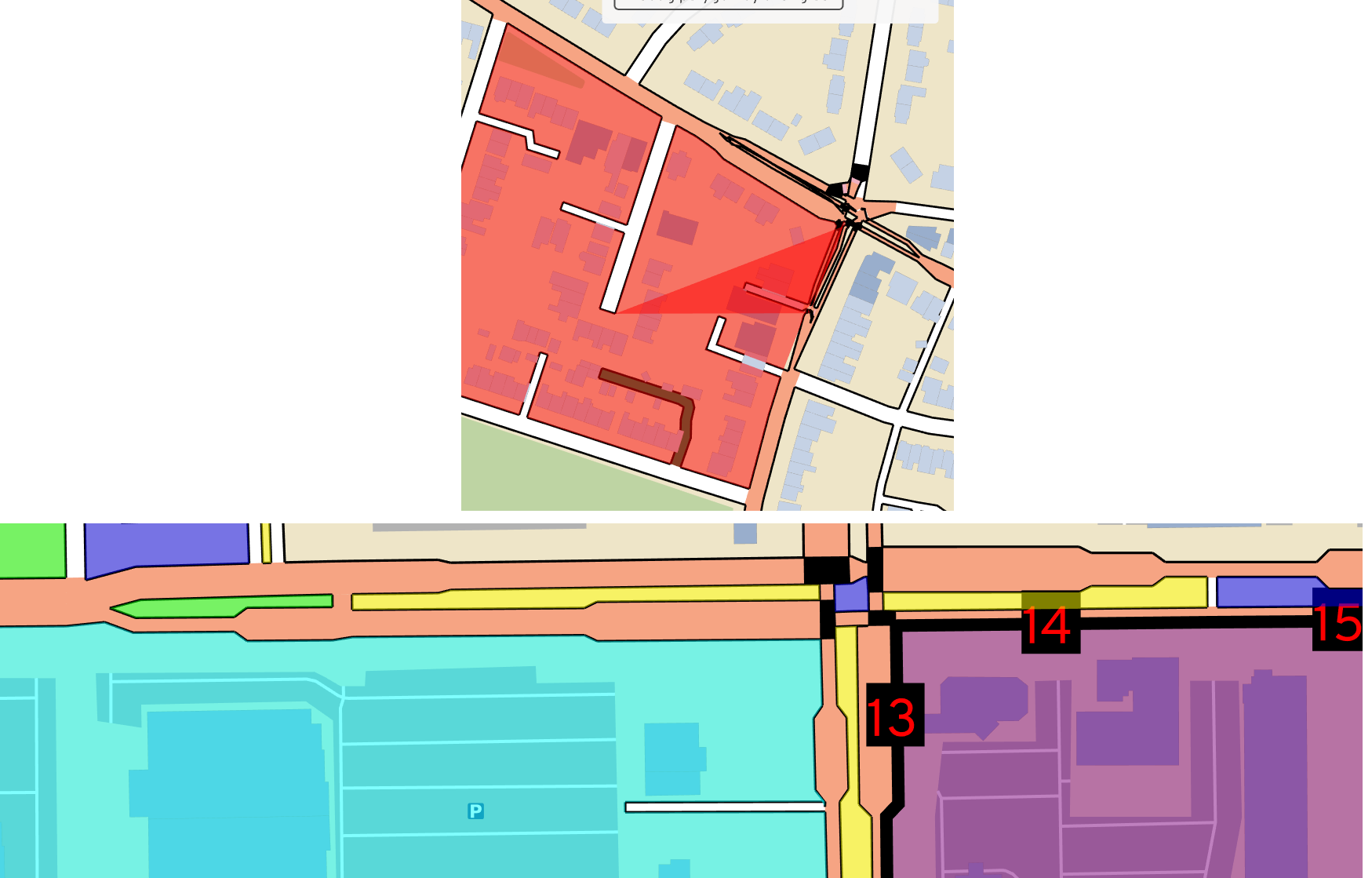
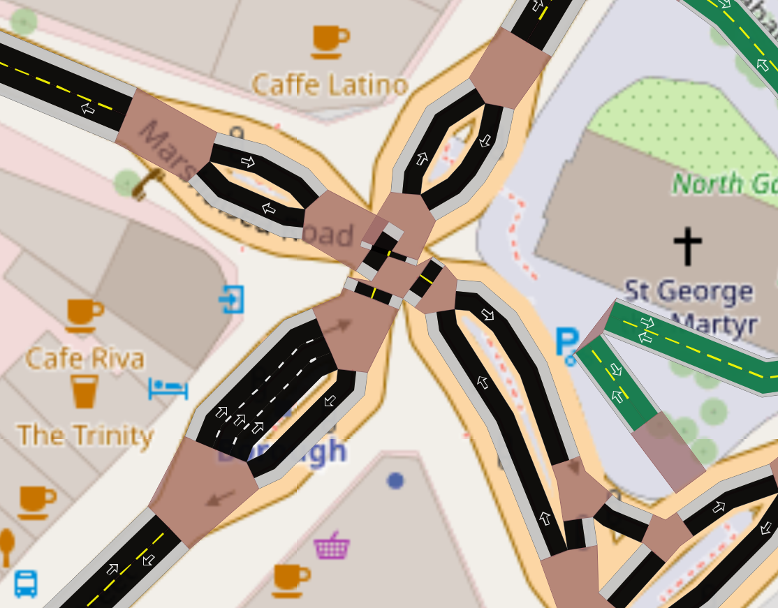
Problem 1: short roads
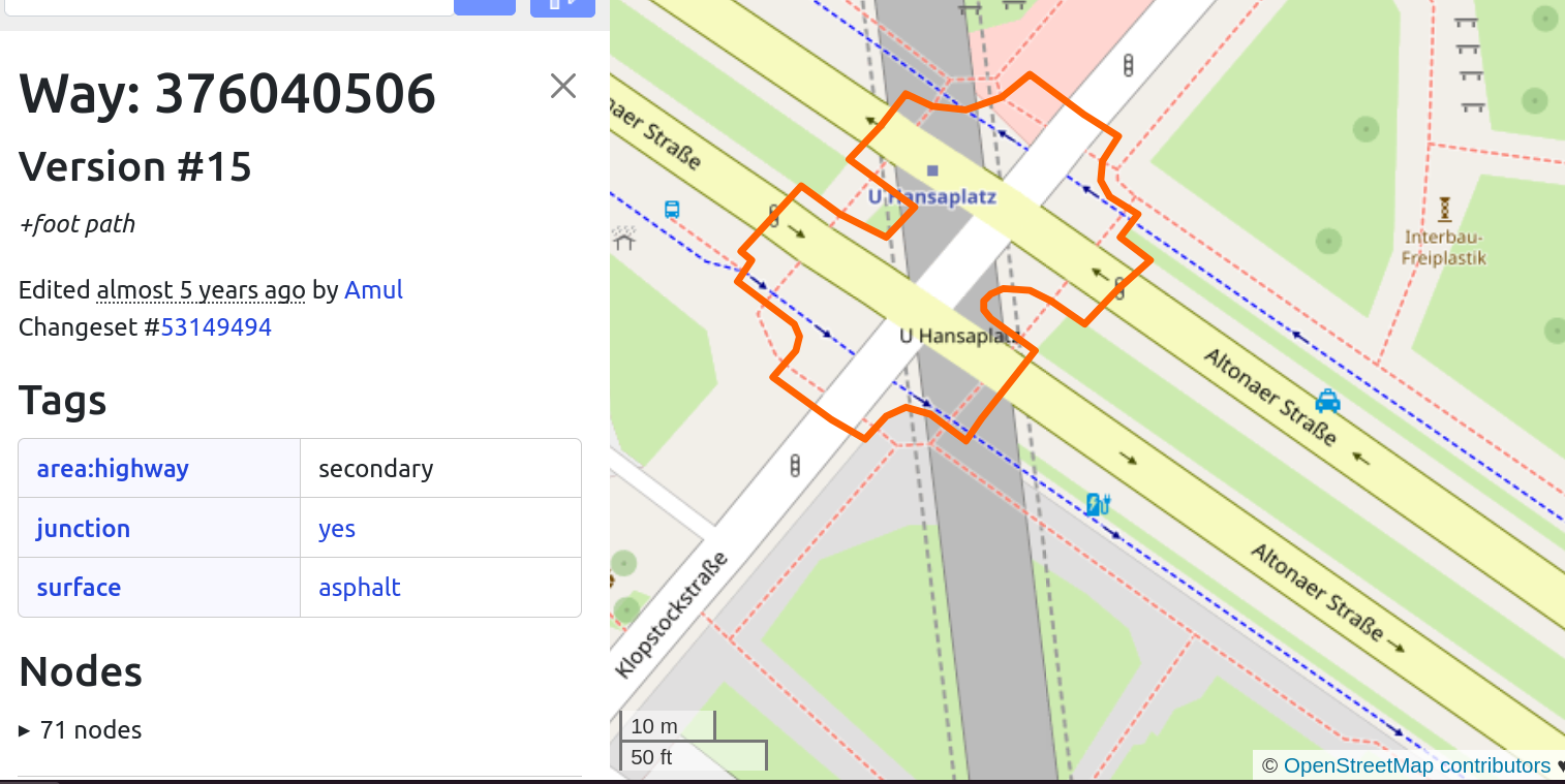
- OSM represents roads as a center-line
- Some segments of that are the middle of an intersection
- “Dog legs” – almost a 4-way intersection
- Also between dual carriageways
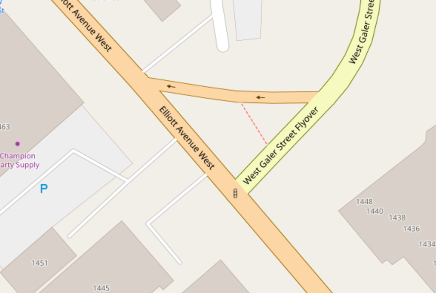
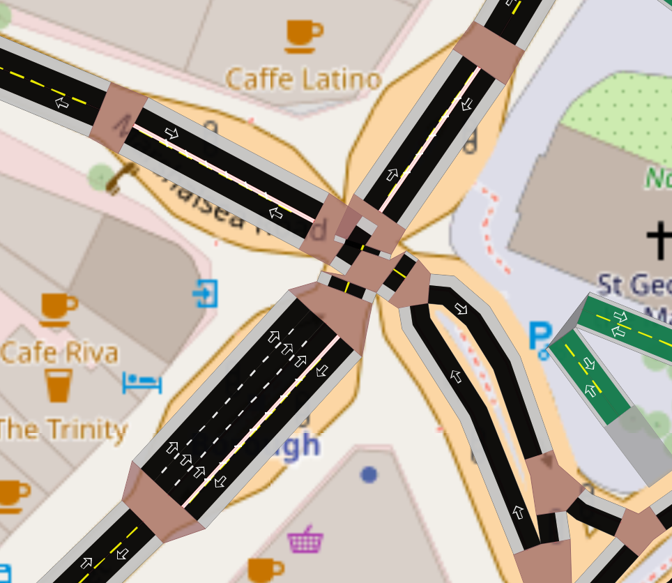
Problem 2: parallel roads, separate objects
Consequences: rendering
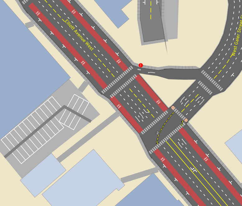
- 8 intersections
- 10 road segments that’re really part of the intersection
Consequences: rendering
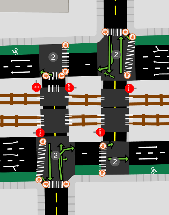
Not ideal, but still usable
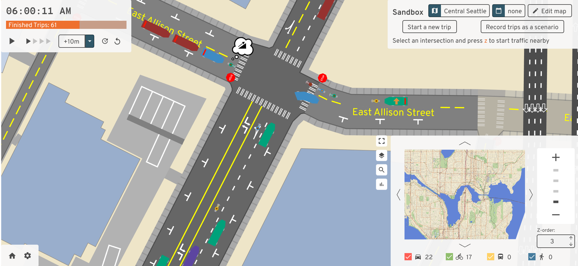
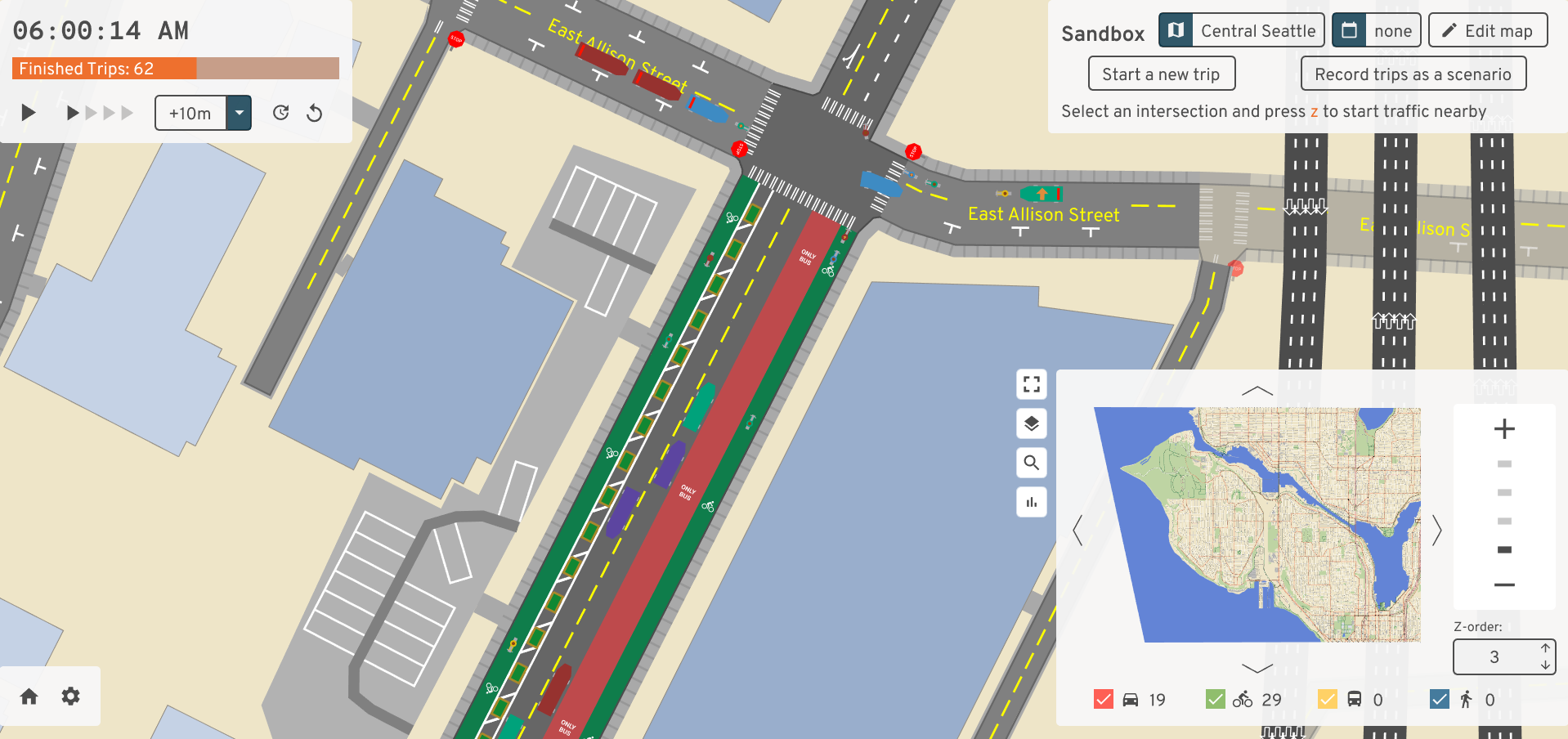
Consequences: traffic simulation
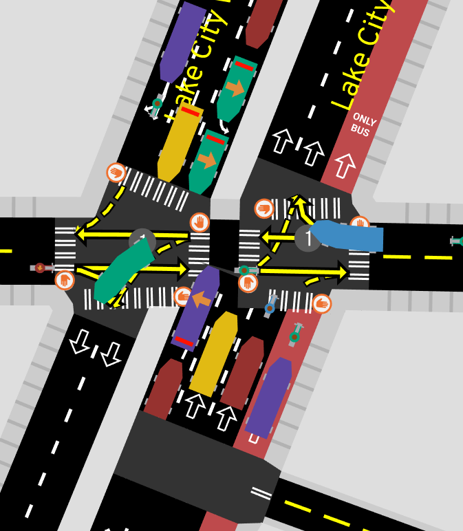
Consequences: traffic simulation
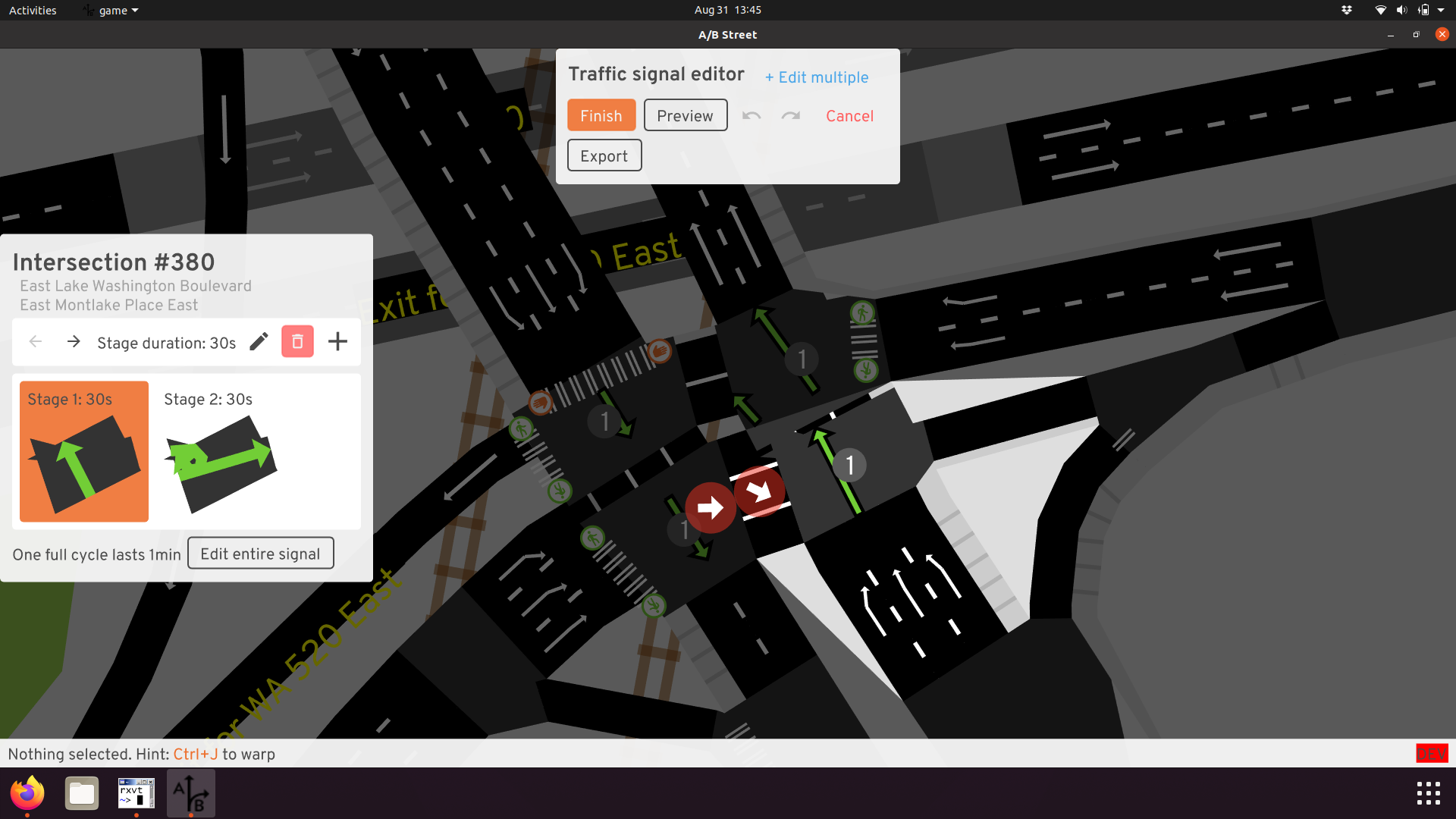
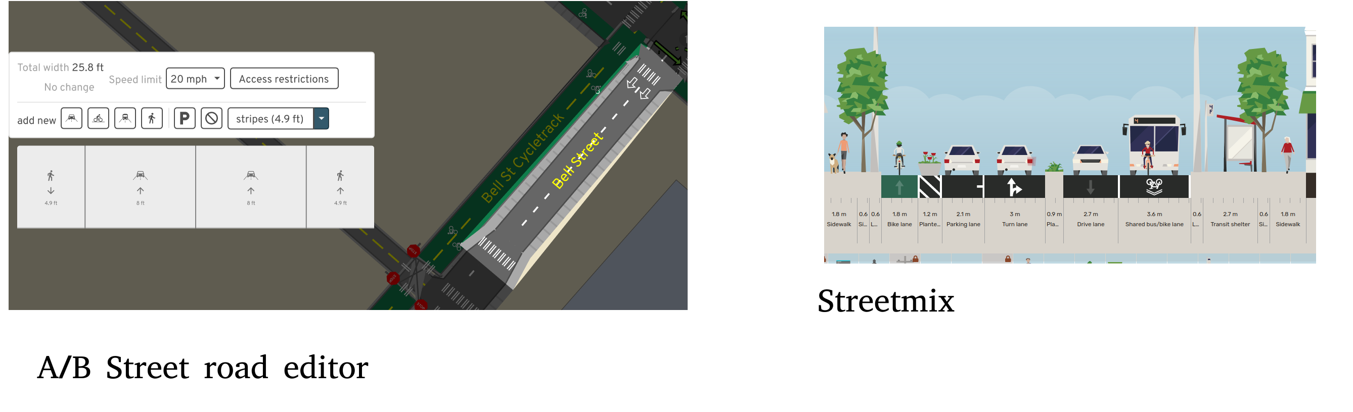
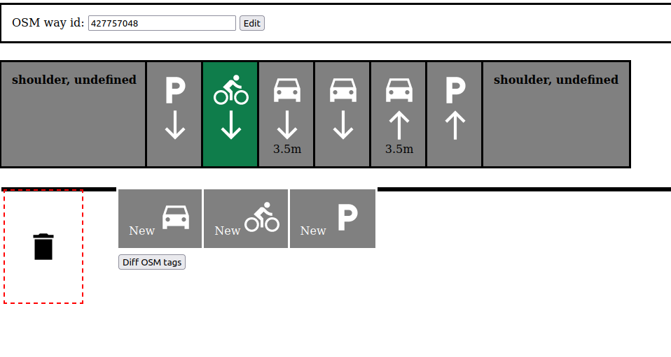
Consequences: editing a road’s lanes
Consequences: tracing between roads
Consequences: other projects
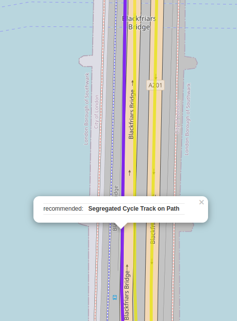
- Cycling Infrastructure Prioritisation Toolkit says Blackfriars need a cycle lane
- Routing instructions / how many traffic signals crossed
Inspiration
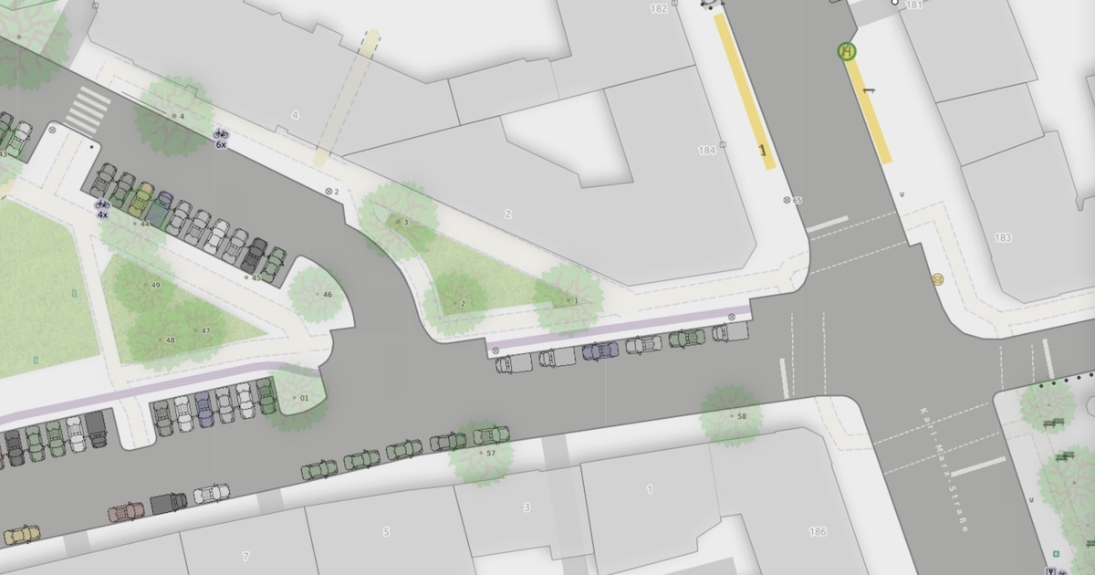
- The state of the art by Berlin OSM community
- https://strassenraumkarte.osm-berlin.org/?map=micromap#20/52.49555/13.42073
- Pocket parking, curb bulbs, complex junctions
Inspiration
Can we do this everywhere?
The architecture
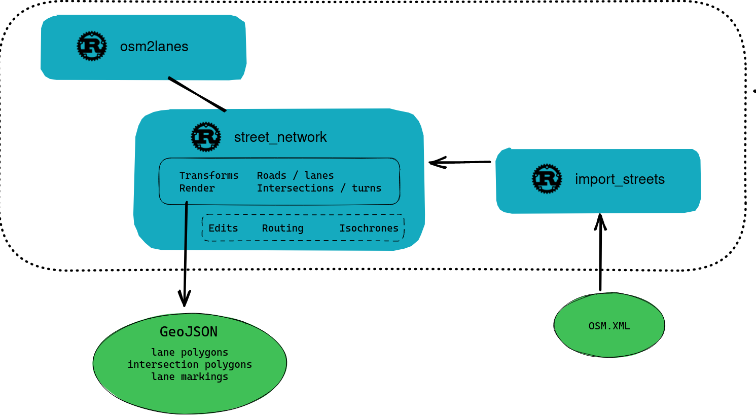
The architecture
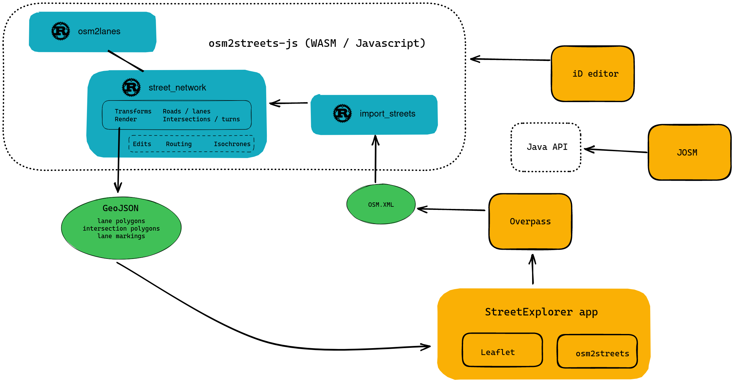
How you can use it: OSM community
- a new renderer for your hard work
- validation for lane tagging
- WIP: osm2lanes editor, don’t learn complex lane tagging
How you can use it: GIS
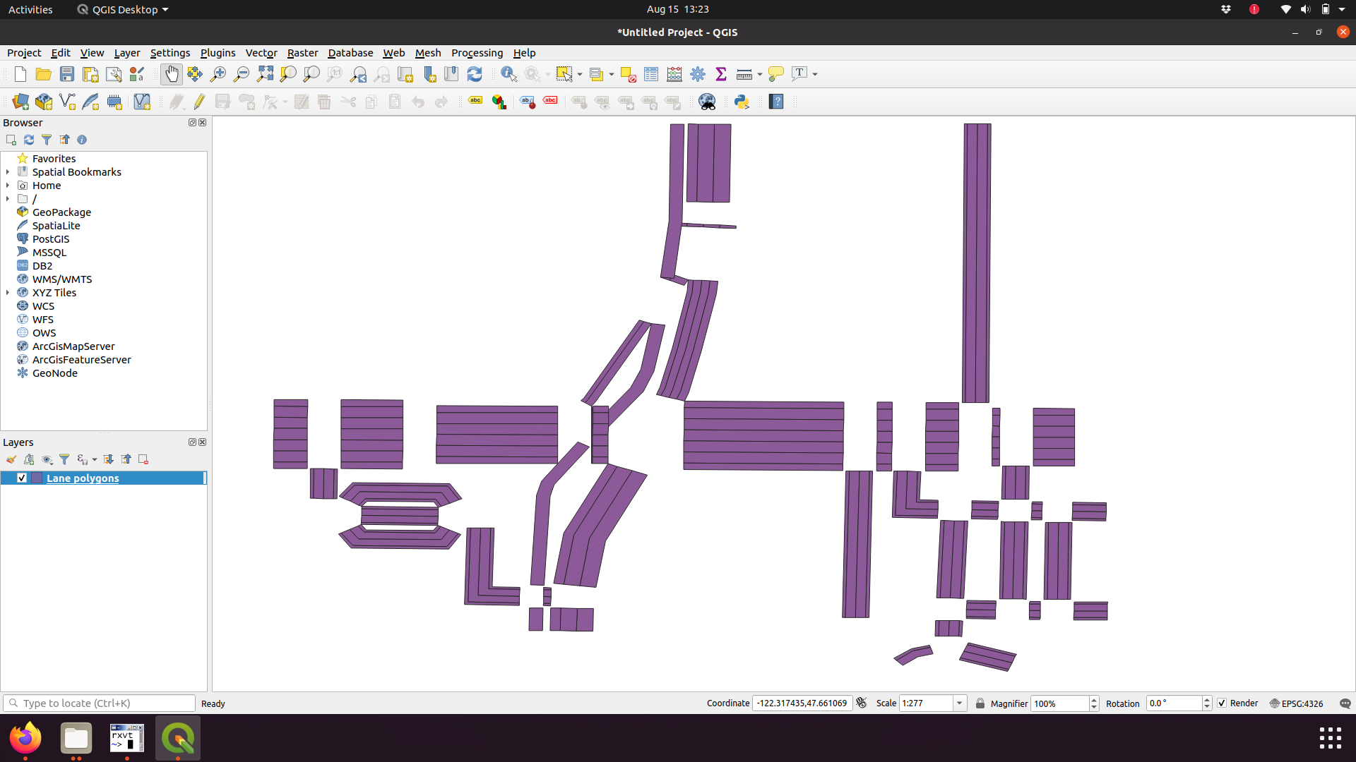
- Export the polygons, use in your QGIS projects
Transformation: simple sausage link
Transformation: simple sausage link
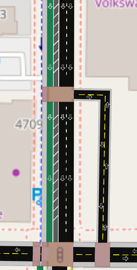
Transformation: separate cycletracks
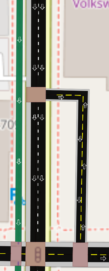
Transformation: separate cycletracks
Promote area:highway tagging
- We’ll never algorithmically figure out all the cases
- Make it easier to map the curb or more detail for hard cases
- osm2streets can generate reasonable defaults for most cases
- How can osm2streets use existing tagged areas to override?