Census data tool proposal
Dustin Carlino
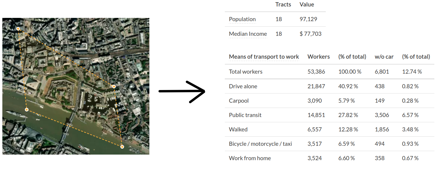
Census data for any boundary polygon
What
- Web tool: Draw a boundary, get demographic breakdown of people living / working there
- and an API: from any language, give a boundary polygon, and get demographic breakdown
- Worldwide scope, “pay as you go” model for data
Why
- How many people live near a bus stop or bike-share station?
- Between 18-30, employed, not owning a vehicle…
- Who lives inside a proposed low-traffic neighborhood, or nearby where traffic is expected to detour in the short-term?
- Are air-quality sensors equitably distributed? https://github.com/alan-turing-institute/spatial-inequality
- Input into synthetic population pipelines
Many researchers reinventing the same wheel – why?
How (the data)
How (the code)
- idea: store in one FlatGeobuf file
- Proof of concept for US census blocks by Michael Kirk
- HTTP range requests to cheaply fetch what’s needed (3-4MB over 8-10 requests for one small city)
- no hosted API to productionize; just a file!
- Rust client library
- Bindings for any language, cross-platform, WebAssembly, Jupyter notebooks