osm2streets
Generating OpenStreetMap street networks with better geometry
7 July 2022, ASG Birmingham
OpenStreetMap primer
OSM primer
OSM representation of streets
- Node: Points with key/value strings
- Way: Line-string with key/value strings
OSM representation of streets
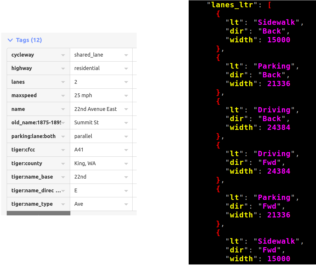
- The way’s attributes describe the lanes, direction, speed limit, access restrictions…
- The way has to be split when any of these change
Footpaths and cycle paths: as attribute
Footpaths and cycle paths: as attribute
- People don’t like tagging this way
Footpaths and cycle paths: as separate ways
- Also for dual carriageways
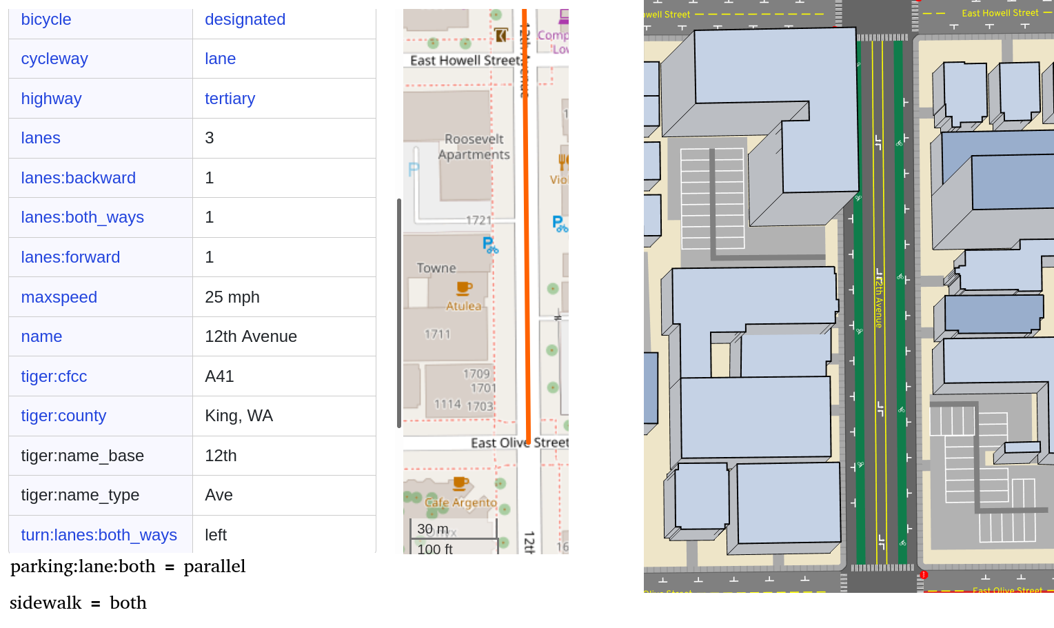
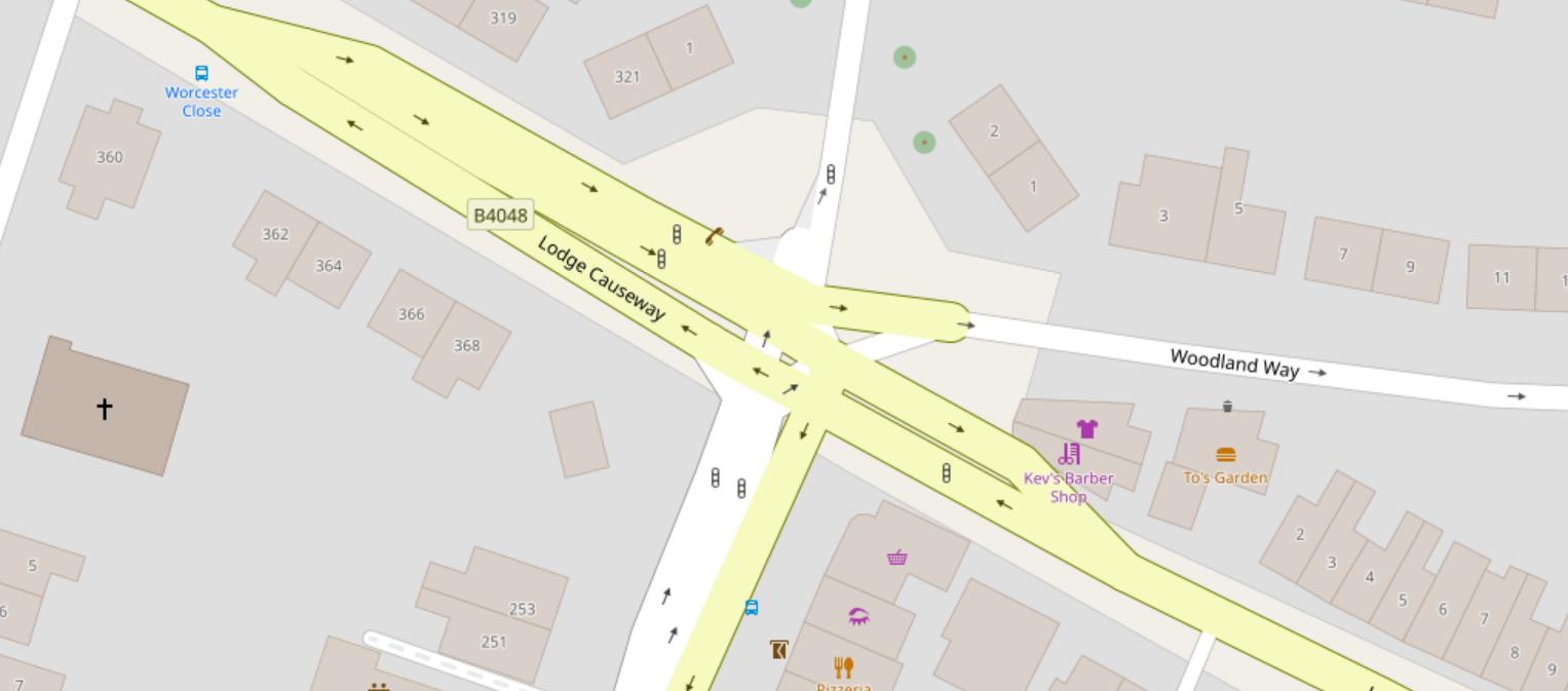
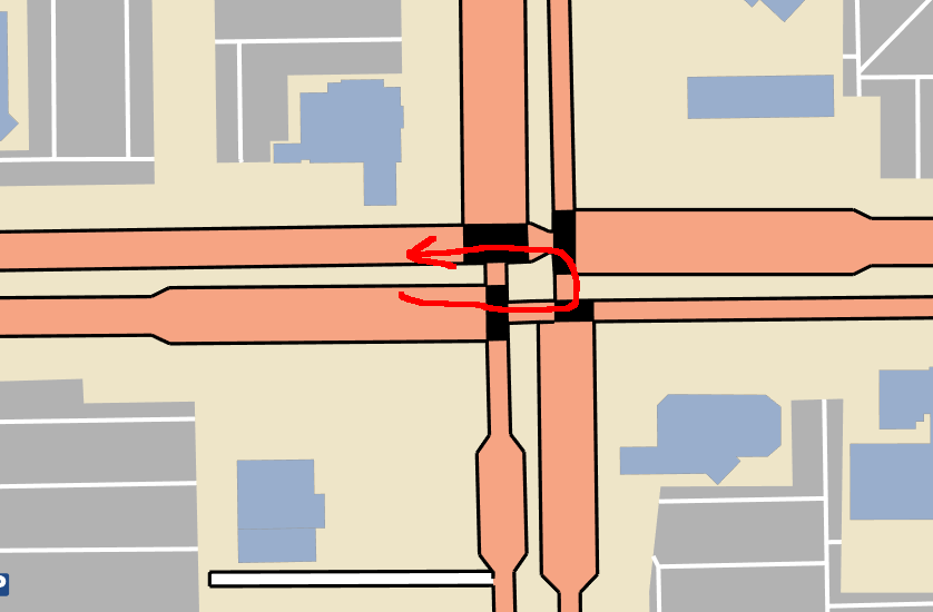
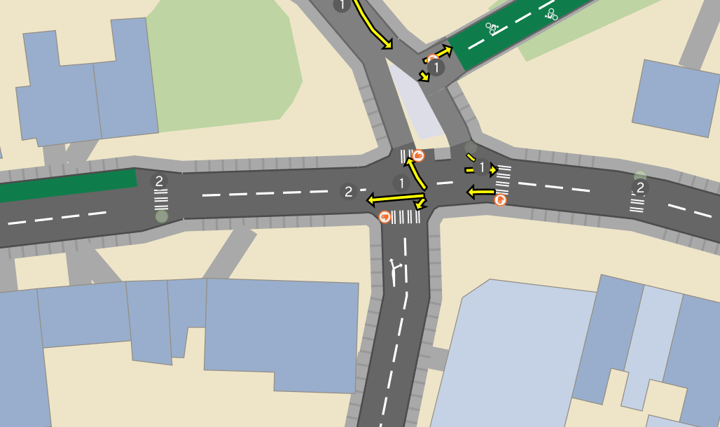
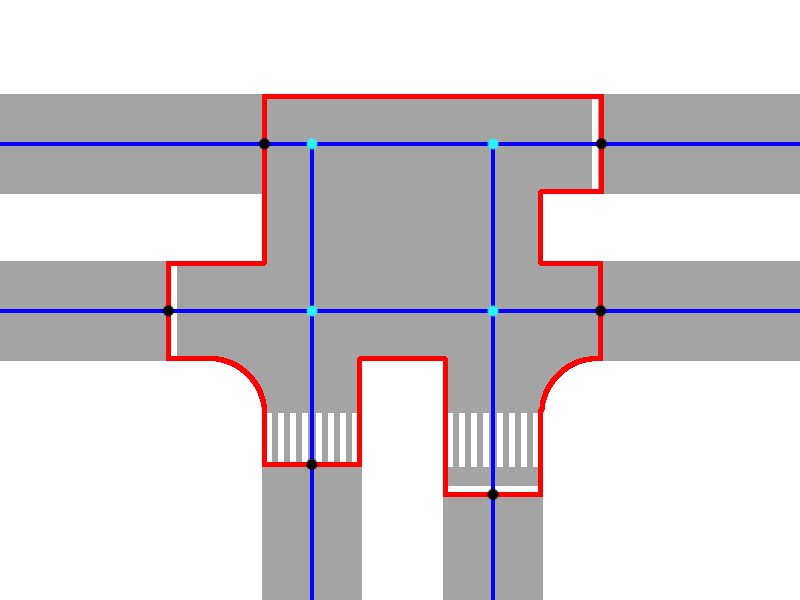
Rendering
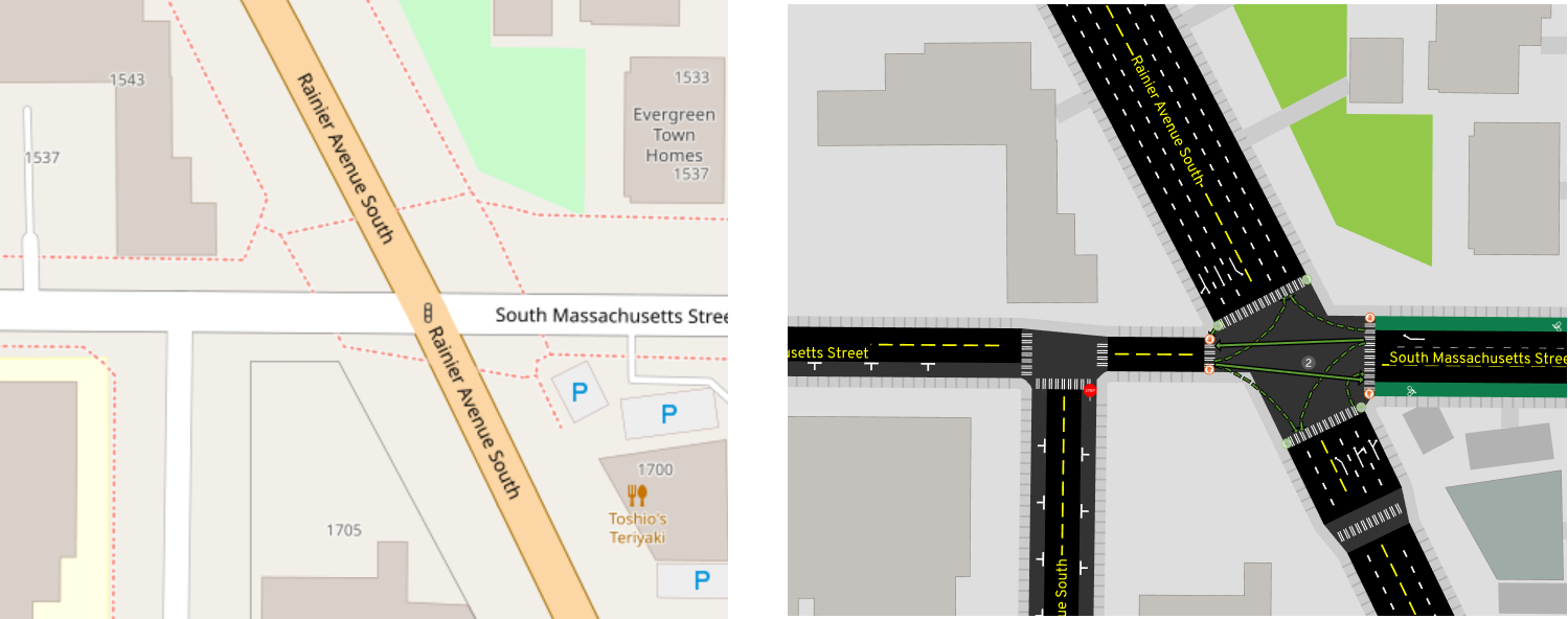
- Ideally we can do this
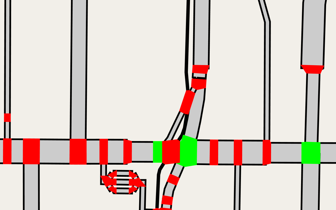
- Note intersection polygons are guessed from road width
Rendering
- Different OSM roads overlap each other
Rendering
Rendering
Rendering
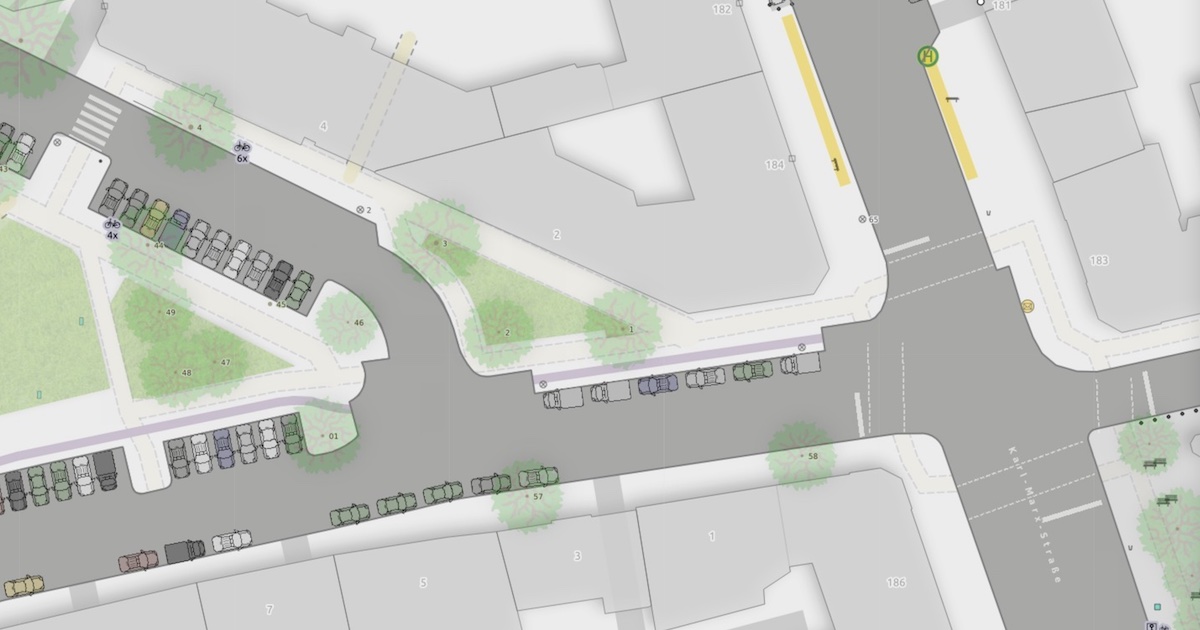
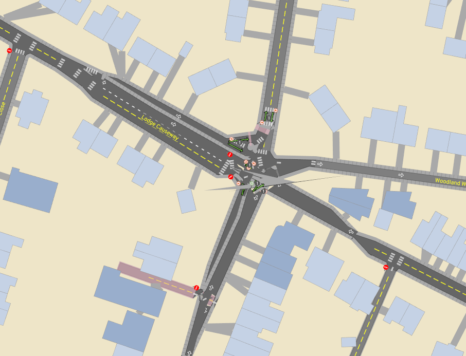
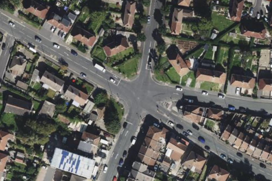
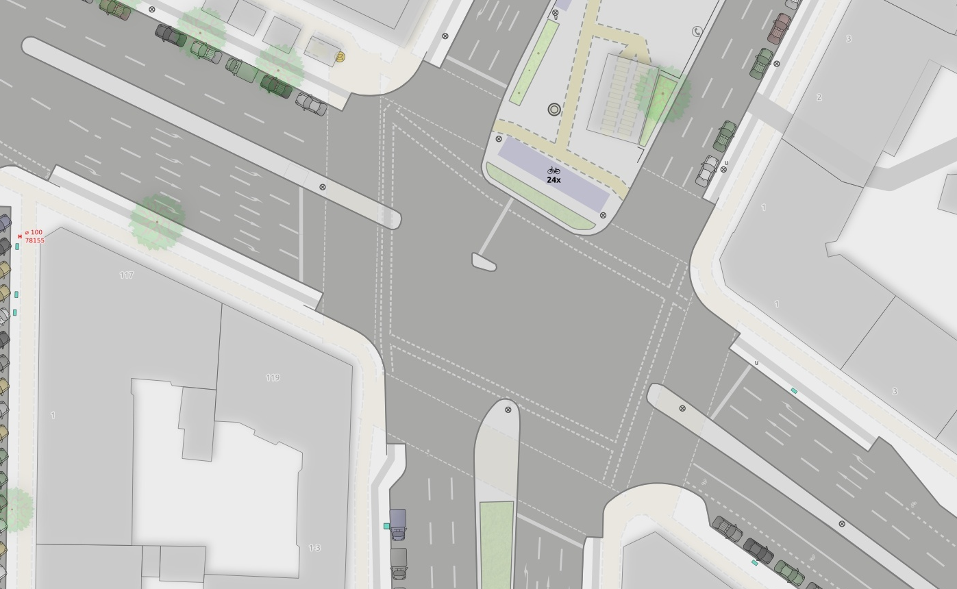
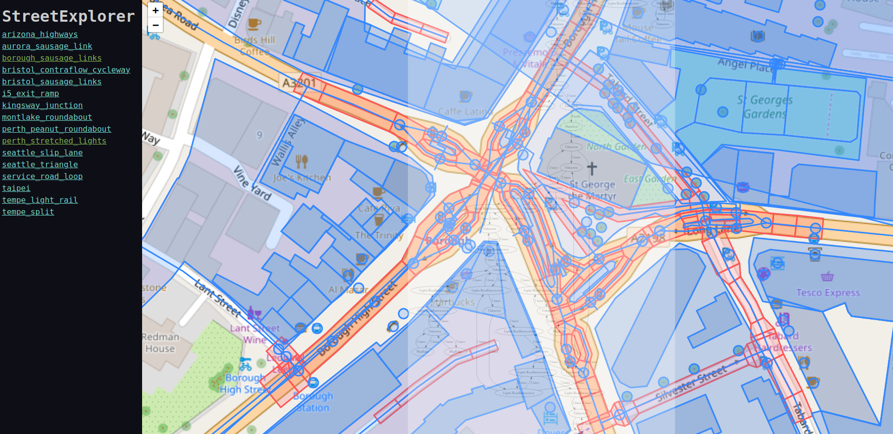
- The state of the art by Berlin OSM community
- https://strassenraumkarte.osm-berlin.org/?map=micromap#20/52.49555/13.42073
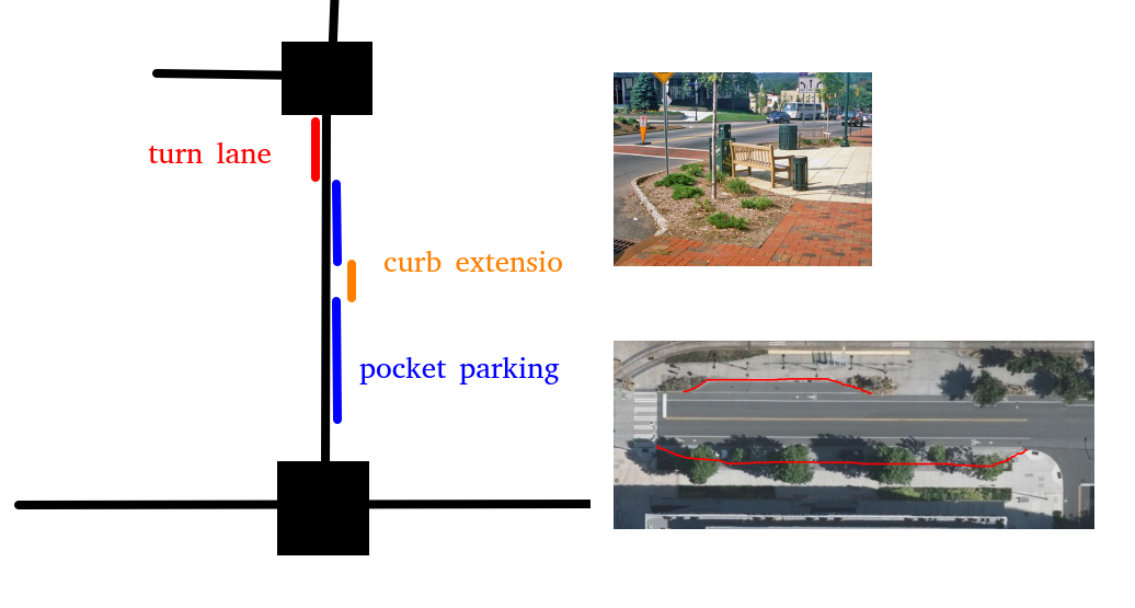
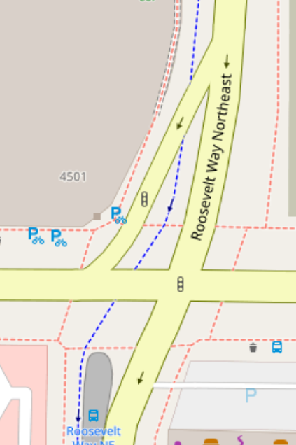
- Pocket parking, curb bulbs, complex junctions
Rendering
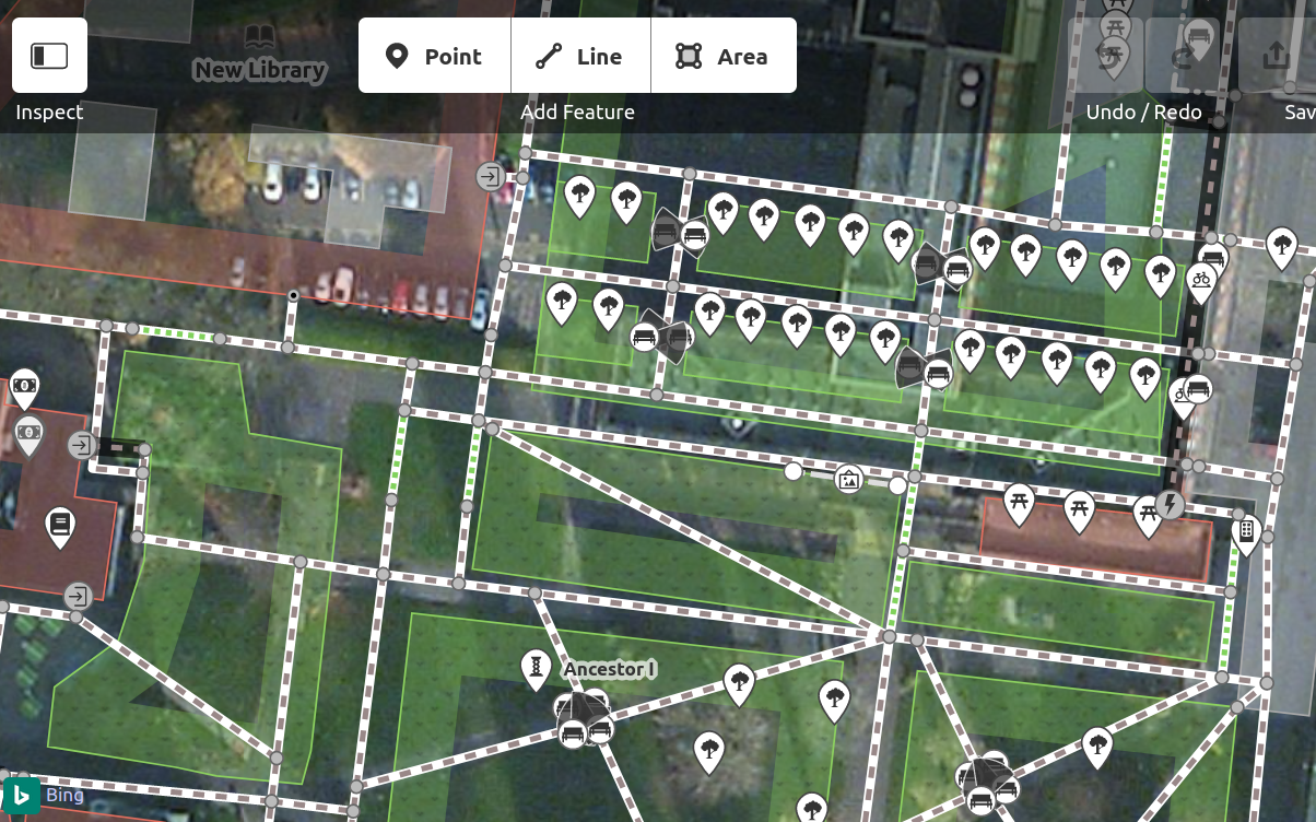
Editing a road by lanes
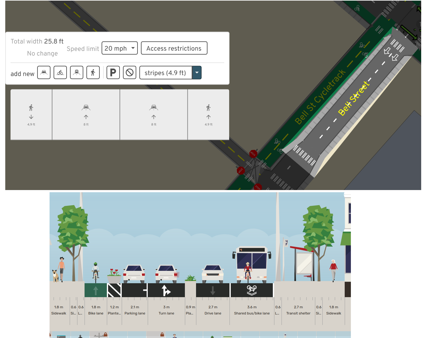
A/B Street (top) & Streetmix (bottom)
- For civic engagement, or just to correct OSM data more easily
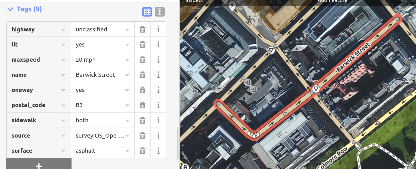
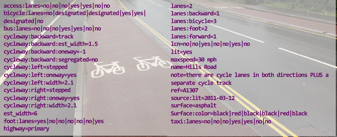
Statistics per road
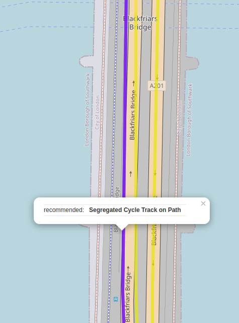
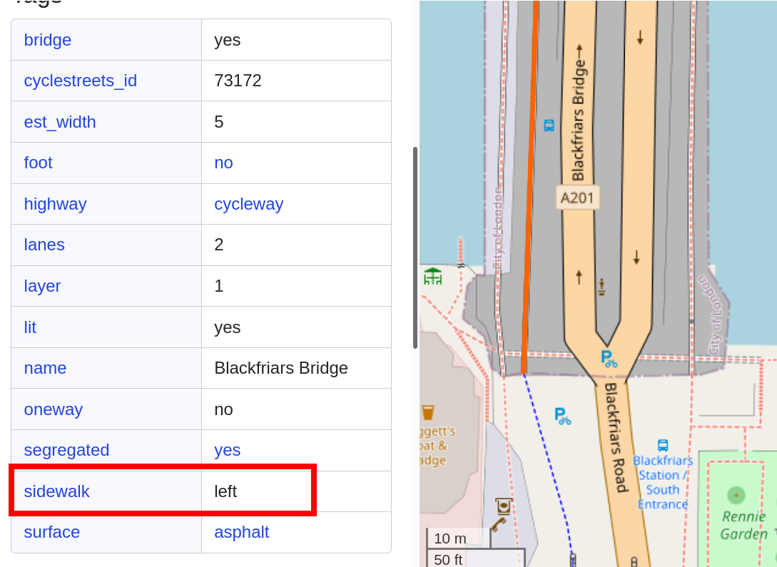
- Cycling Infrastructure Prioritisation Toolkit says Blackfriars need a cycle lane…
- Spatial inequality of streets without sidewalks
- How many collisions along a divided highway?
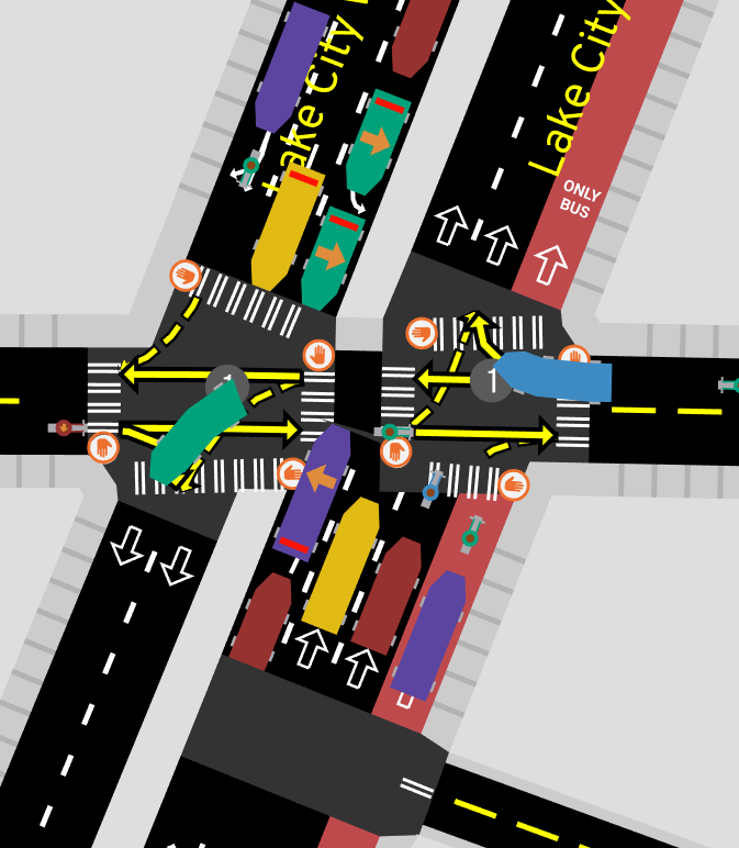
Routing instructions
- Every SatNav ever: “Use the right lane to bear slightly left, then take a sharp right”
- A human: “Turn right at the intersection”
- Cost function for how many traffic signals crossed
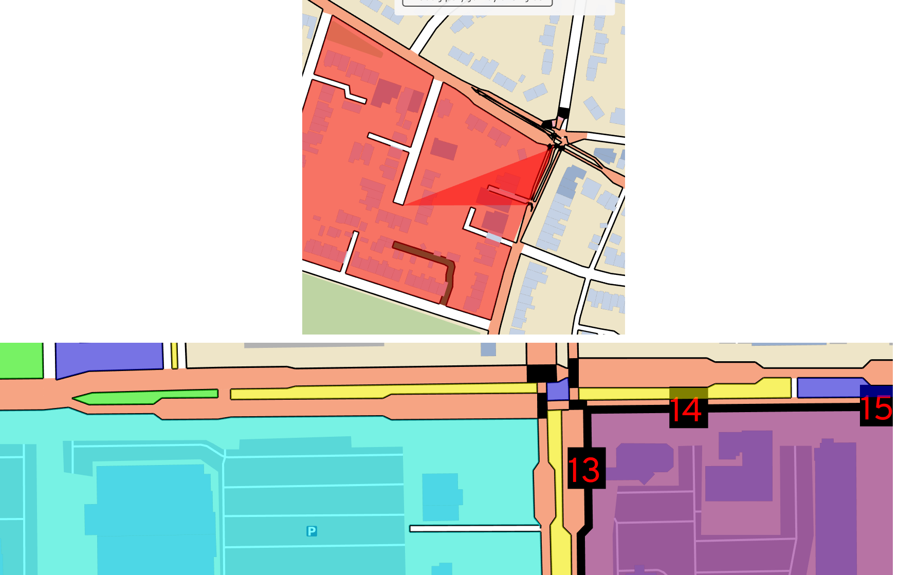
Blockfinding
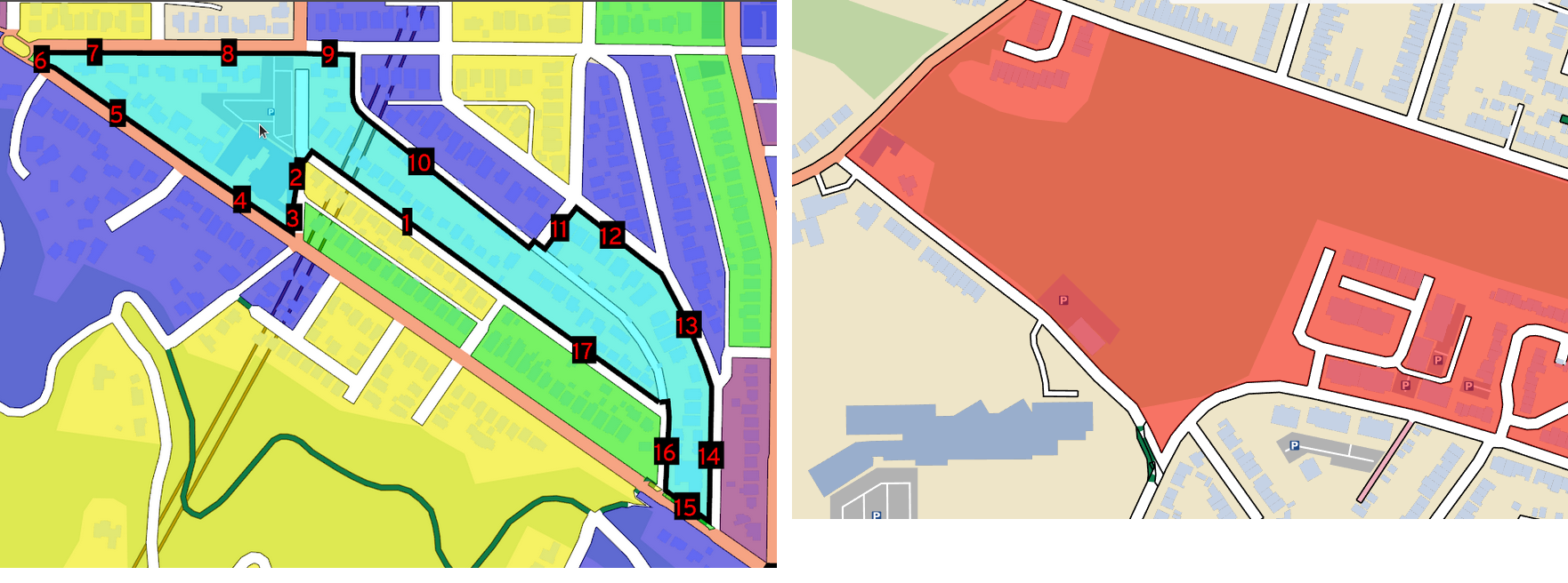
- Traces the inside of a “city block”, exactly following road outlines
Blockfinding
Traffic simulation
- Rules about not blocking junctions
Traffic signal timing
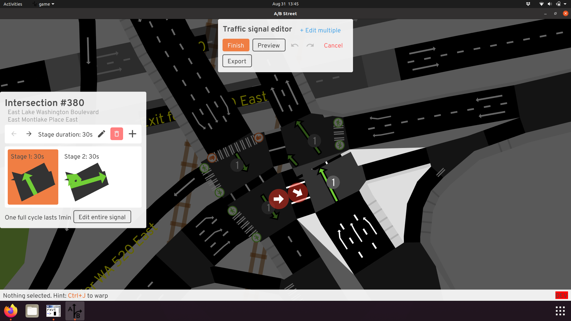
- Editing UI and automatic heuristics
osm2streets
osm2streets
- Browse test cases: https://a-b-street.github.io/osm2streets/
- OSM input, GeoJSON output: https://github.com/a-b-street/osm2streets/tree/main/tests/src/bristol_sausage_links
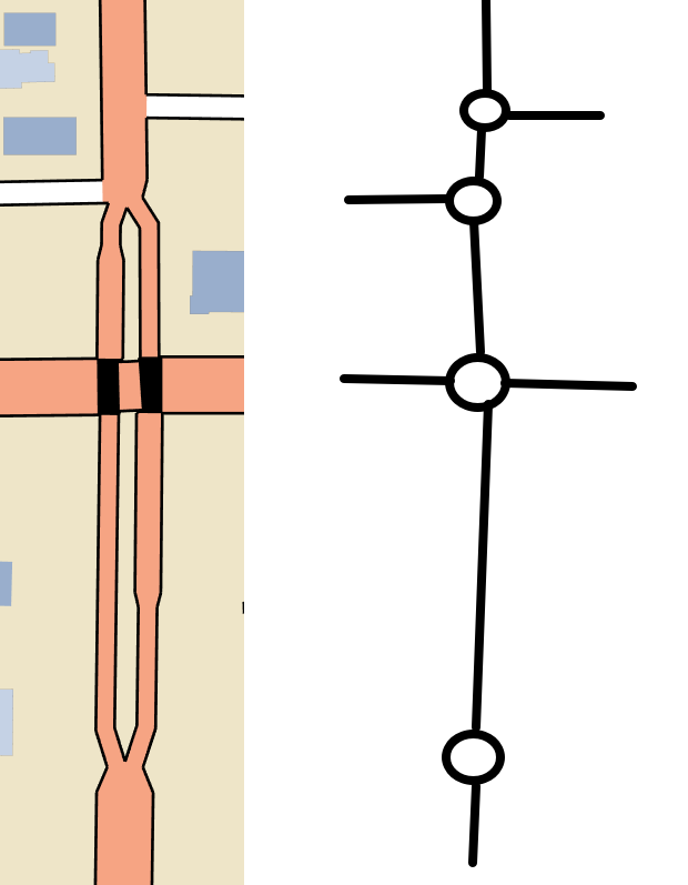
osm2streets: example transformation
- Both geometry and graph properties used
- Remove edge
- Remove one of the nodes (arbitrarily)
- Connect edges to the surviving node
- Use points from original polygons to form the final
- Preserve turn restrictions?
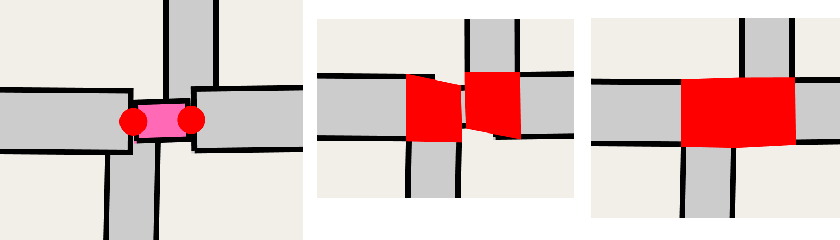
osm2streets: sausage links

- Why’s the road split?
osm2streets: sausage links
- Geometry: straight line, ignore the bend drawn (or “average” two line-strings?)
- Lanes: Append in left-to-right order
osm2streets: sausage links
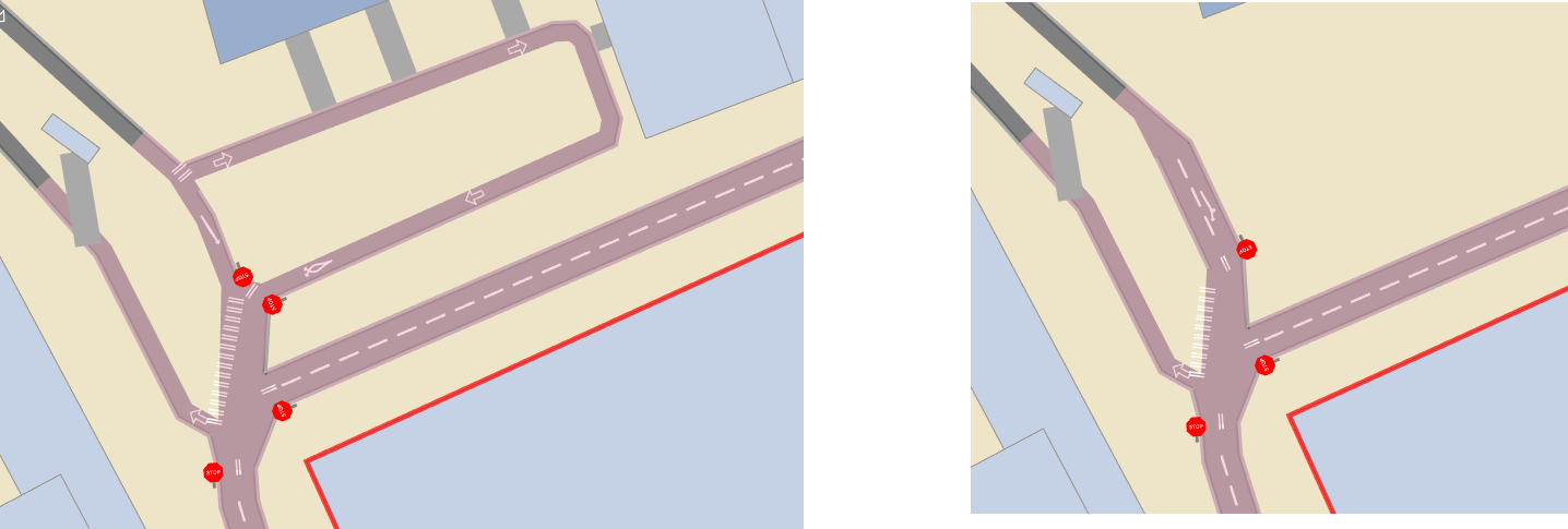
- One-way directions are the same
- Length of two roads is very different
- Distance between equivalent points on line-strings changes
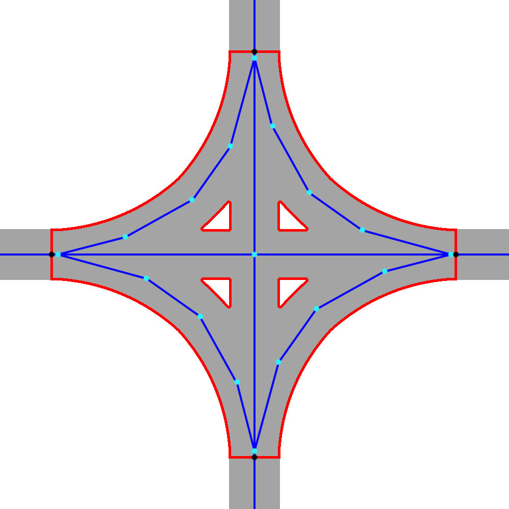
osm2streets: dual carriageways
- Slight generalization of sausage links
osm2streets: dual carriageways
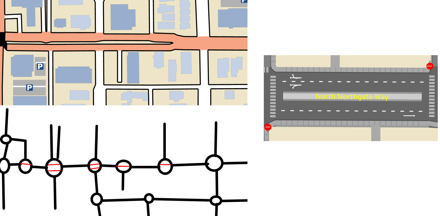
- Preserve graph structure
- Median/verge lane in the middle
- Turn restrictions for the junction
osmstreets: merging parallel ways isn’t easy
Cycle lanes crossing slip lanes
osmstreets: merging parallel ways isn’t easy
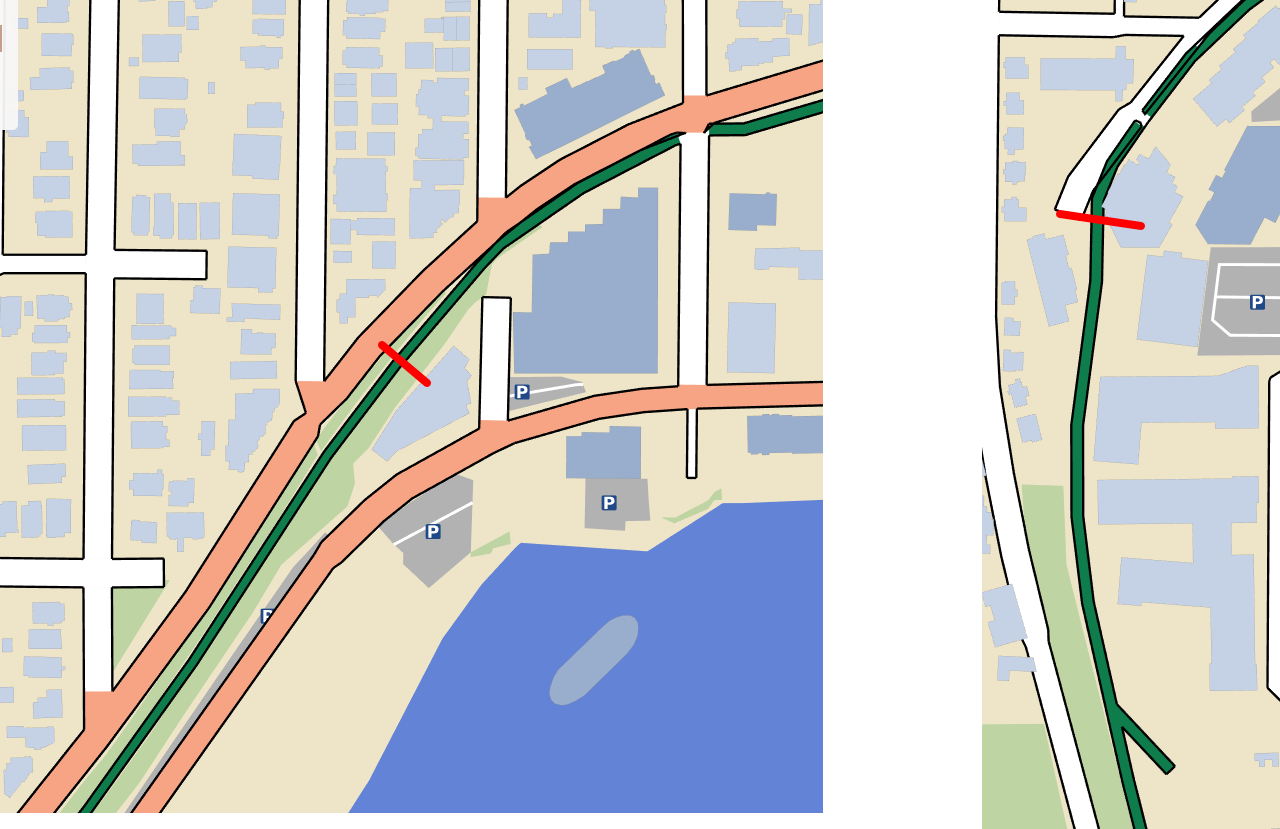
- Cyclepath is sometimes part of the road, sometimes legitimately a separate path
- New splits?
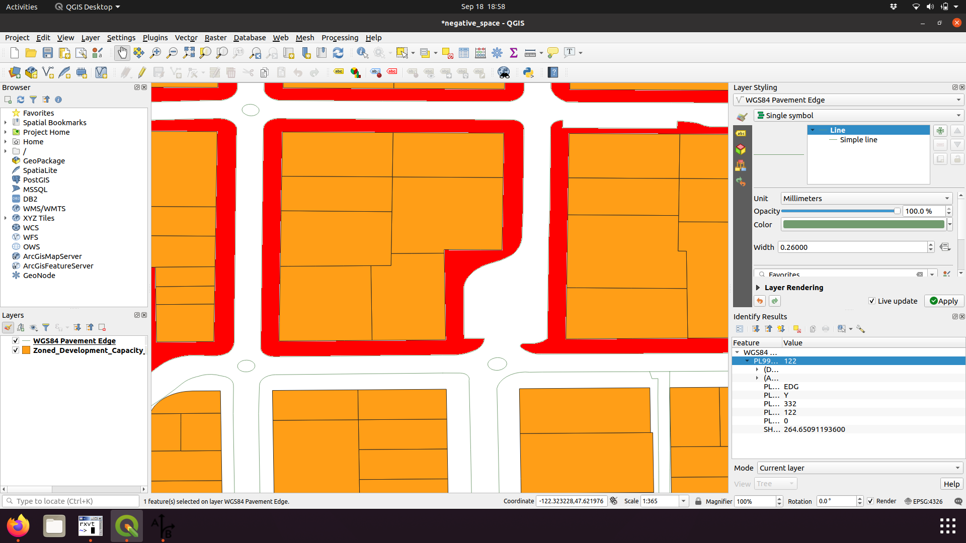
Find width between buildings/areas
Tag areas in OSM?
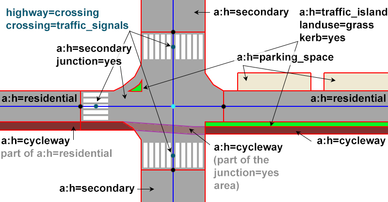
Tag areas in OSM?
Tag areas in OSM?
An idea for turn lanes and pocket parking